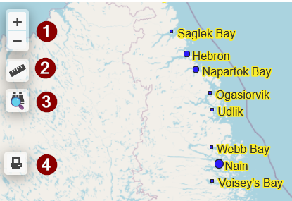
1) Zoom in/Zoom out
2) Measure tool. Measure distance and area.
3) Feature search. The selection dynamically filters the search layer (different for each map) while typing. Delete the entry to reverse/clear the selection.
4) Print. Current map zoom and screen content printed to file or printer.
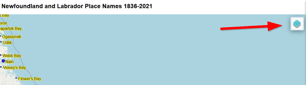
Click here to expand the map legend
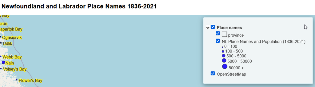
Legend entries can be toggled on or off
The mission of NL Maps is to encourage people to lean more about the history of Newfoundland and Labrador by using interactive maps (GIS). Historical information takes on an extra dimension when location is included. Where adds to who, what, when and why. NL Maps would like to acknowledge the sources from which the maps were compiled. The sources include the Memorial University of Newfoundland and Labrador Digital Archive Initiative, the Provincial Archives and the City of St. John's. There is so much more NL history to be mapped and shared. If anyone would like to learn more or contribute, please contact us.